Building surveys
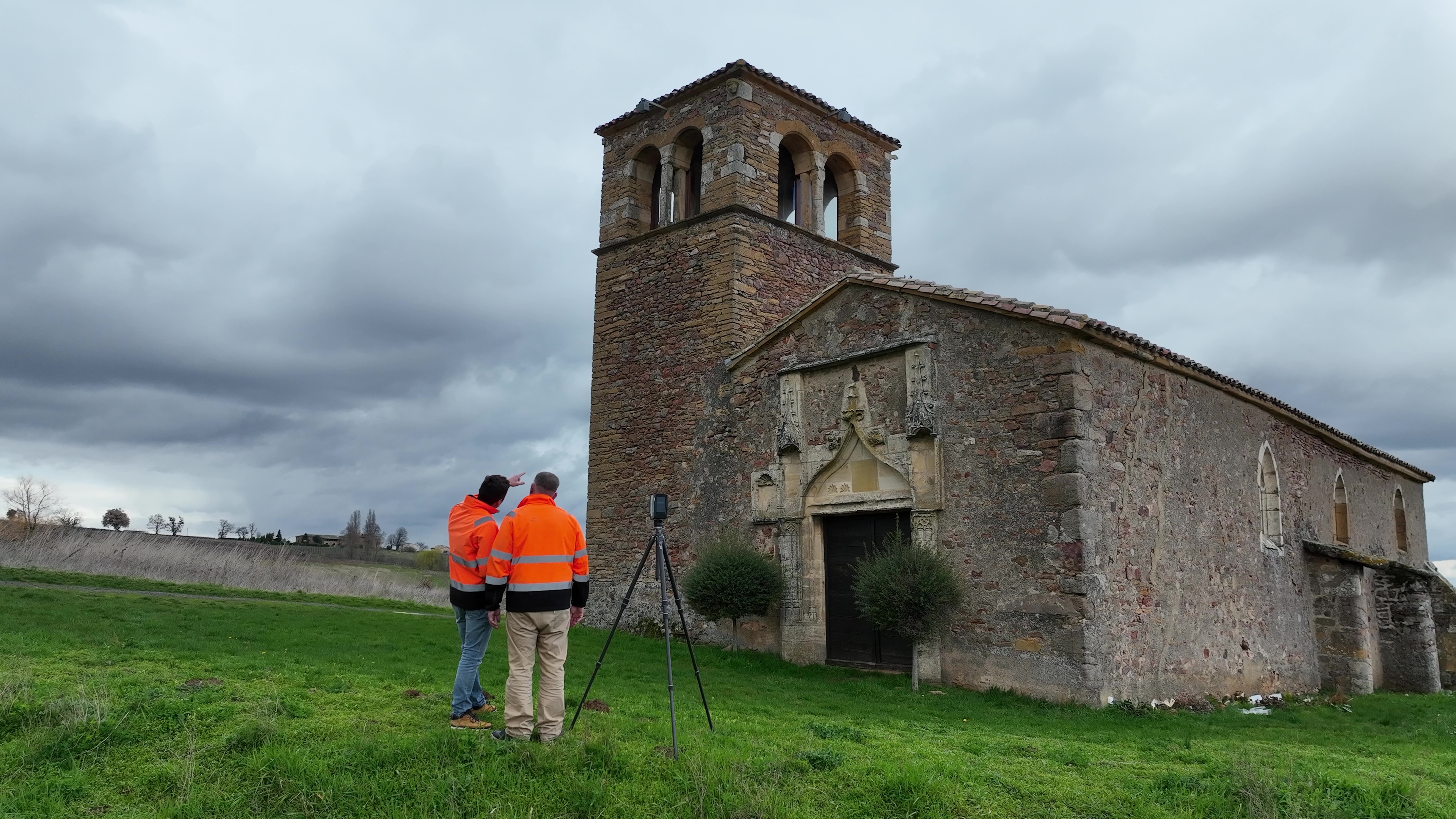
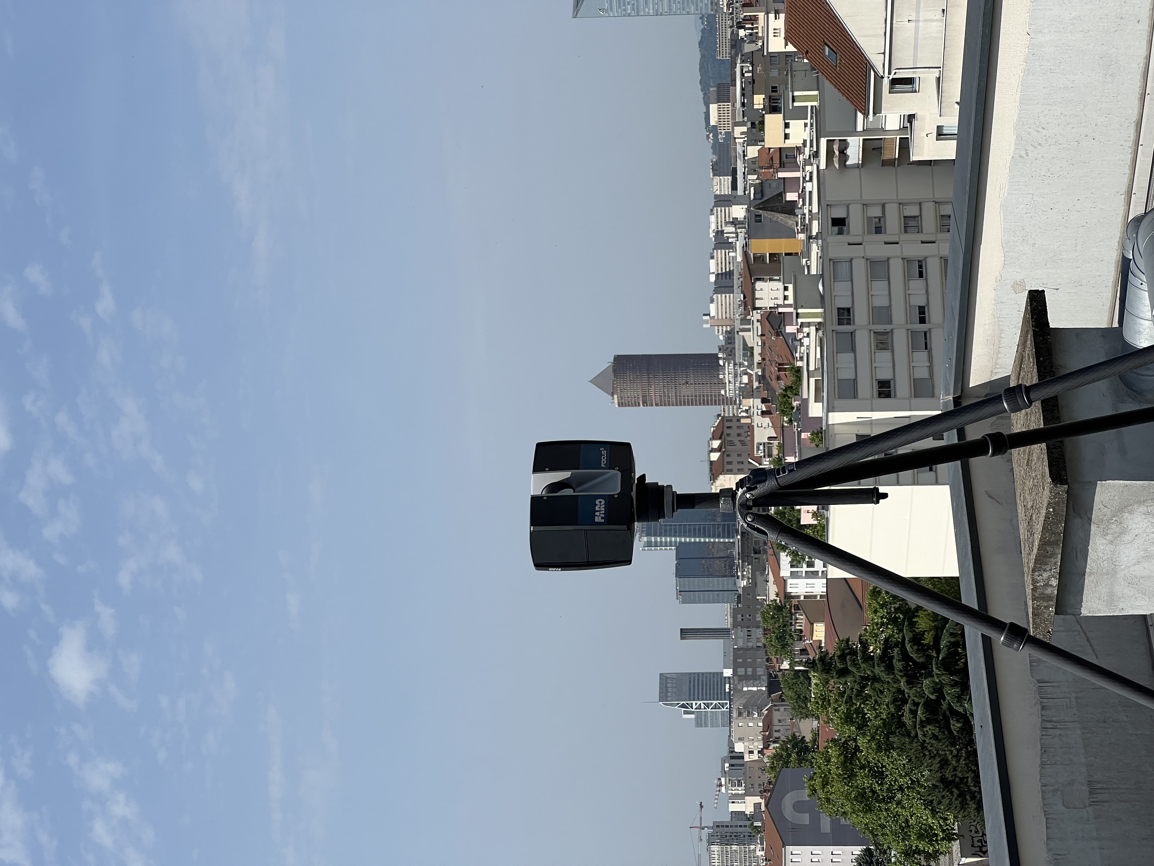
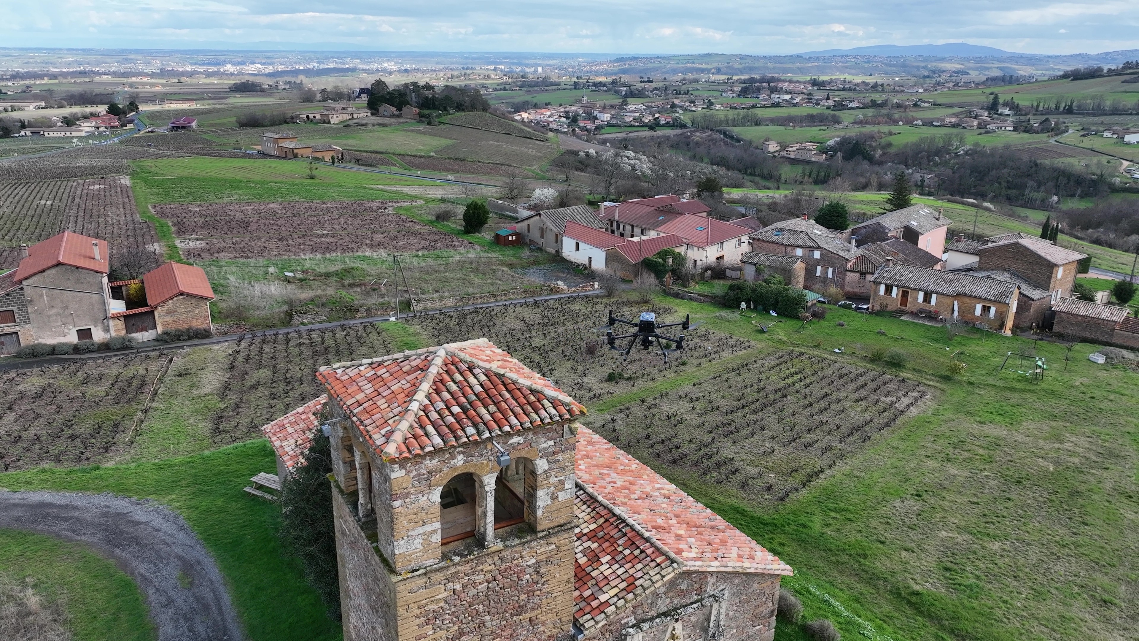
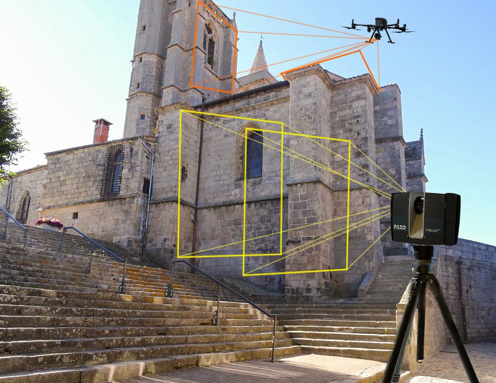
Semageospatial takes surveys using scanners and drones, allowing us to make both 2D and 3D plans.
This unique approach consists of combining high-precision land (interior/exterior) and aerial surveys to create a 3D model, rendering the site in its entirety.
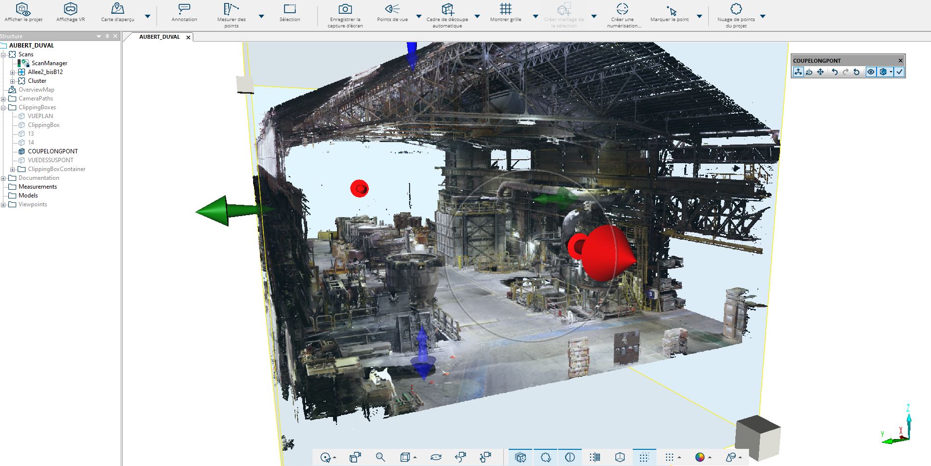
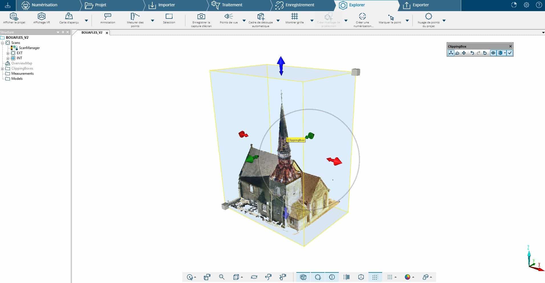
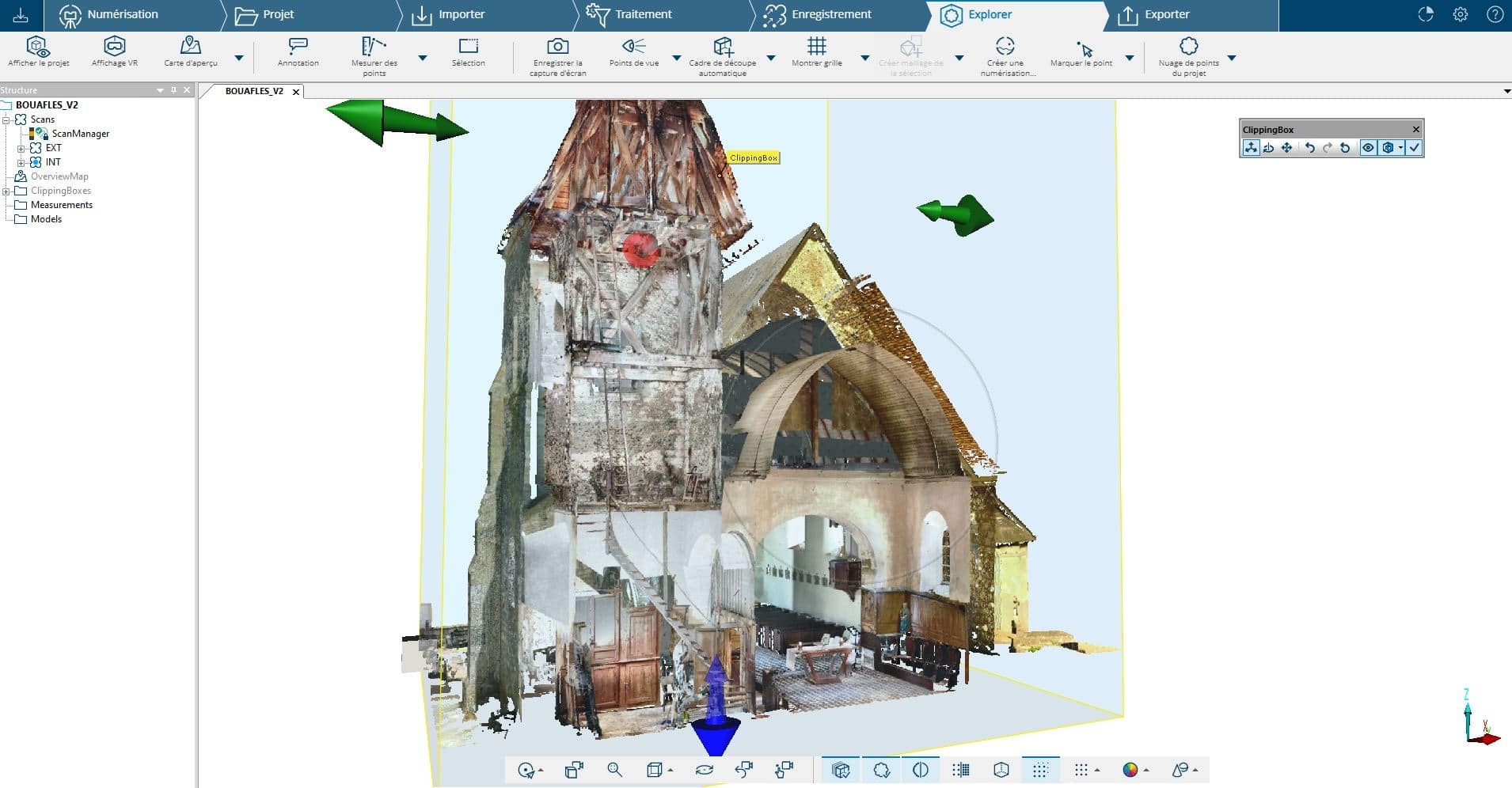
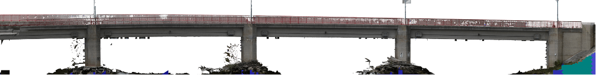
We create a point cloud which gives us a 3D representation of the site as it is, no matter how high or hard to access it may be. This can then be integrated into your CAD software (distance measurements, surface area calculations, annotations, etc.)
Using these surveys, we then provide you with a 3D viewer. This is a data sharing solution that gives you a 360° view of your project on your computer, just like you were actually on the site.
An easy to use measuring tool, you can take all the measurements you need without leaving the office.
Surveys of roofs, façades, and interior surfaces (even hard-to-reach and complex zones)
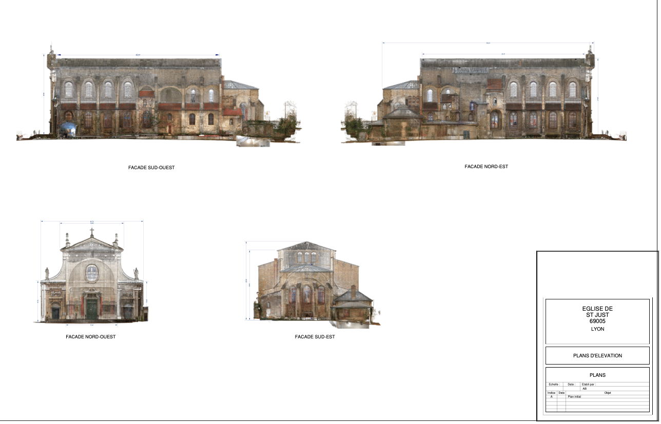
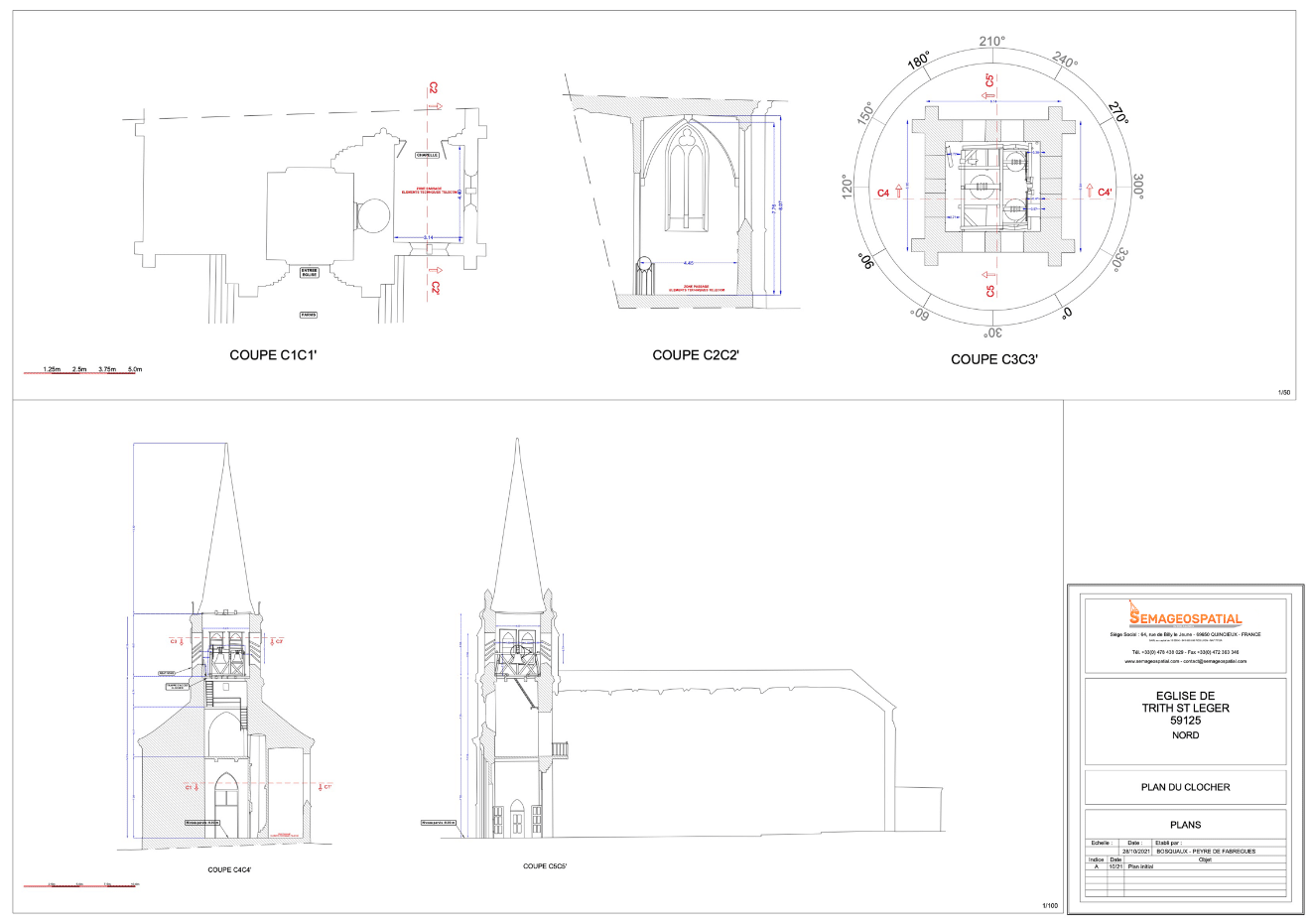
We provide the digital supports you want:
- Cleaned, classified, and georeferenced point clouds
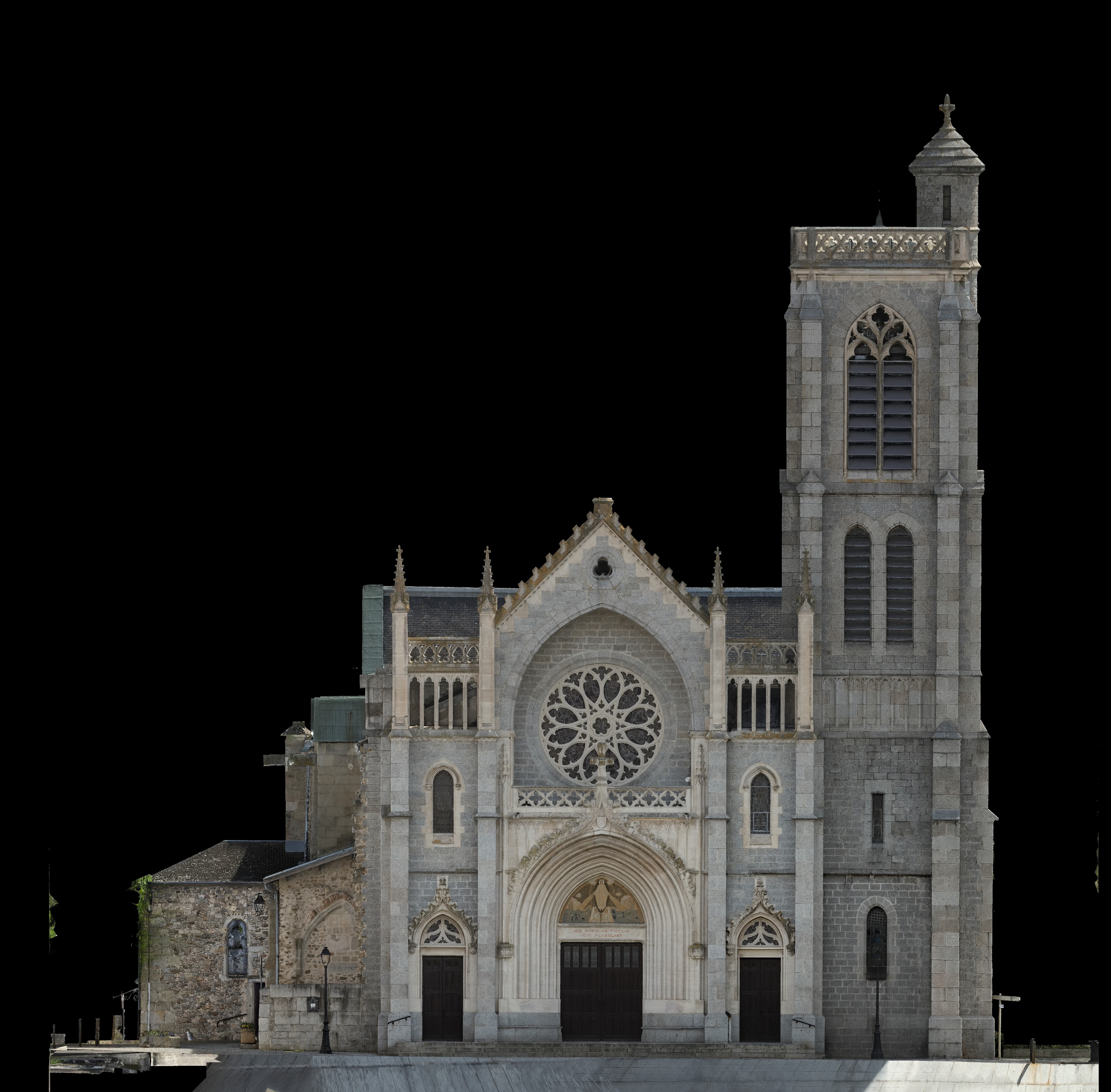
- Orthophotography
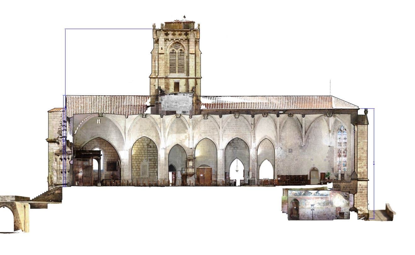
- Floor plans, cut-aways, façades, and more
- 2D plans
- 3D models for presentation and printing